About AOT
Histories
Prior to the Setting Up of the Airports of Thailand Public Company Limited On 17 December 1903, the Wrights Brothers succeeded in flying an engined aircraft which was the real beginning of flying in the world. As a result, various nations were quick to appreciate the future importance of flying. Eight years later, a Belgian pilot, Van den Born flew to Thailand, taking the “Orville Wright” to perform the first flight show from 2 – 8 February 1911 at Sa Pathum Horse Racing Course, now known as the Royal Bangkok Sports Club.
Thailand displayed an active interest in having airplanes for self – protection and air transport. On 28 February 1911, Thailand sent three officers to train in France. They were Major Luang Sakdi Sanlayawut (Sunee Suwanprateep), Captain Luang Arwut Sikikorn (Long Sinsuk) and First Lieutenant Tip Ketuthat. The three officers attended a flying training course in France where flying was at an advances stage of development.
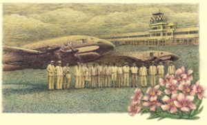
 Having completed their training, they also visited many places in Europe and returned to Thailand on 2 November 1913 with eight airplanes that the Thai government had ordered. The four Breguets and four Nieuports were the first batch of Thai aircraft. Fittingly, the three new pilots became the first group of pilots and were honored to be the forefathers of the Royal Thai Air Force.
The Ministry of Defence transferred the aviation activities to be under the command of the Army Engineer Inspector General Department and then a temporary hangar was constructed in back of the Police Patrol
School, Pathumwan. Today this is the location of the Police Department. Part of the Sa Pathum constructed in back of the Police Patrol School, Pathumwan.
Today this is the location of the Police Department. Part of the Sa Pathum Horse Racing Course was Sa Pathum airfield, Thailand’s first airport.
Don Mueang (International) Airport (IATA: DMK, ICAO: VTBD) (or also (Old) Bangkok International Airport) is an airport in Bangkok, Thailand. The airport was officially opened on March 27, 1914, although the field had been in use earlier. The main field before the opening of Don Mueang International Airport was the Sa Pathum airfield. On September 28, 2006 the airport was replaced by Suvarnabhumi Airport. The airport is now only in use for charter flights.
Don Mueang was an important hub of Asia and the hub of Thai Airways International. Don Mueang served the most air traffic in Thailand. As of 2005 more than 80 airlines served the airport and over 38,000,000 passengers, 160,000 flights and 700,000 tons of cargo were handled at this airport per year. In 2005 it was the 18th busiest airport in the world and 2nd in Asia by passenger volume.
 Don Mueang is a joint-use facility with the Royal Thai Air Force's Don Mueang Royal Thai Air Force Base, being the home of the RTAF the 1st Air Division, consisting primarily of non-combat aircraft. Vibhavadi Rangsit Road is the main route linking the airport with downtown Bangkok. The Uttaraphimuk Elevated Tollway, running above Vibhavadi Rangsit, offers a more rapid option for getting into the city and connects to Bangkok's inner city expressway network. Besides travelling by road, there is train service connecting to Hua Lamphong station in the center of town. The railway station is across the highway and linked with the airport by walkway bridge.
Within a month of transferring to Suvarnabhumi, several low-cost airlines asked to move back to Don Mueang.[1] Airports of Thailand resisted the move and the government's Department of Aviation rejected the plan.As Suvarnabhumi Airport is current operating at near capacity, the idea of re-opening Don Mueang International Airport for low-cost airlines is being considered to help ease the traffic at Suvarnabhumi Airport.
In addition to its current use as a terminal for charter flights, military aircraft and civil aviation Don Mueang might become a hub for aircraft maintenance.
There is a golf course located between the
two runways. The course has no separation whatsoever from the runway, and people are only held back by a red light when airplanes land and cross the golf course. From the aerial/satellite pictures below one can see the greens and bunkers quite well.
